The Geography of Scotland
The Physical Geography of Scotland
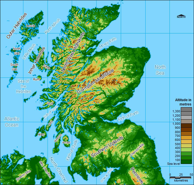
Scotland makes up a third of the island of Great Britain. It has 790 islands mainly in the Shetland, Orkney and Hebrides islands. The Geography of Scotland is usually divided in to three parts namely the Highlands & Islands, the Central Lowlands, and the Southern Uplands. It is bounded in the east by the North Sea and in the west by the Atlantic Ocean.
The Highland Boundary Fault
It is split in to a highland and lowland zone along the Highland Boundary Fault which runs from Helensburgh in the west to Stonehaven on the east coast. The highlands contain most of the mountainous area of Scotland.
The Lowland Zone
The lowland zone contains the densely populated Central Belt which is the area between the Firth of Clyde and the Firth of Forth in the east. The bulk of the population of Scotland lives in this central belt. This is where Scotland has seven cities of which Glasgow with a population of 593000 is the largest. Edinburgh, the capital city is the second largest with a population of 487500. Much of Scotland is mountainous with the highest mountain being that of Ben Nevis at a height of 1,344 metres(4,409) feet. This makes it one of the ‘Munros’. That is one of the mountains over 3000 feet(914.4 metres) of which there are 284 in Scotland. The coastline of Scotland is 6,160 miles (9,910) kilometres long, increasing to 10,250 miles(16,500kilometres) if the islands are included.